Презентация предназначена для обучающихся среднего и старшего уровня общеобразовательной школы с целью знакомства с необычными природными местами нашей страны. Она может быть использована при изучении тем "Мир вокруг нас", "Загадочные места планеты",а также при проведении внеклассных мероприятий по английскому языку. Она позволит узнать много нового о природе России, о ее неповторимости и красоте.
Создайте Ваш сайт учителя Видеоуроки Олимпиады Вебинары для учителей
Чудеса России
Вы уже знаете о суперспособностях современного учителя?

Тратить минимум сил на подготовку и проведение уроков.

Быстро и объективно проверять знания учащихся.

Сделать изучение нового материала максимально понятным.

Избавить себя от подбора заданий и их проверки после уроков.

Наладить дисциплину на своих уроках.

Получить возможность работать творчески.
Просмотр содержимого документа
«Чудеса России»
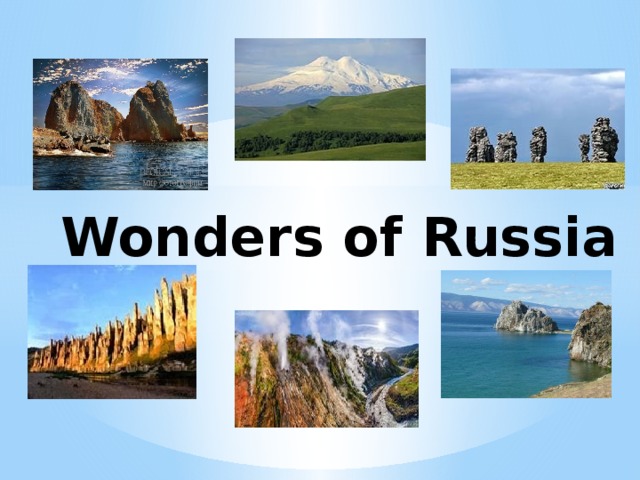
Wonders of Russia
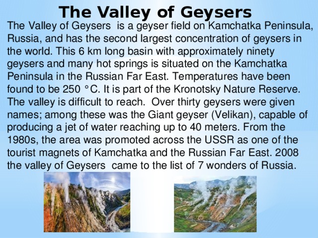
The Valley of Geysers
The Valley of Geysers is a geyser field on Kamchatka Peninsula, Russia, and has the second largest concentration of geysers in the world. This 6 km long basin with approximately ninety geysers and many hot springs is situated on the Kamchatka Peninsula in the Russian Far East. Temperatures have been found to be 250 °C. It is part of the Kronotsky Nature Reserve. The valley is difficult to reach. Over thirty geysers were given names; among these was the Giant geyser (Velikan), capable of producing a jet of water reaching up to 40 meters. From the 1980s, the area was promoted across the USSR as one of the tourist magnets of Kamchatka and the Russian Far East. 2008 the valley of Geysers came to the list of 7 wonders of Russia.
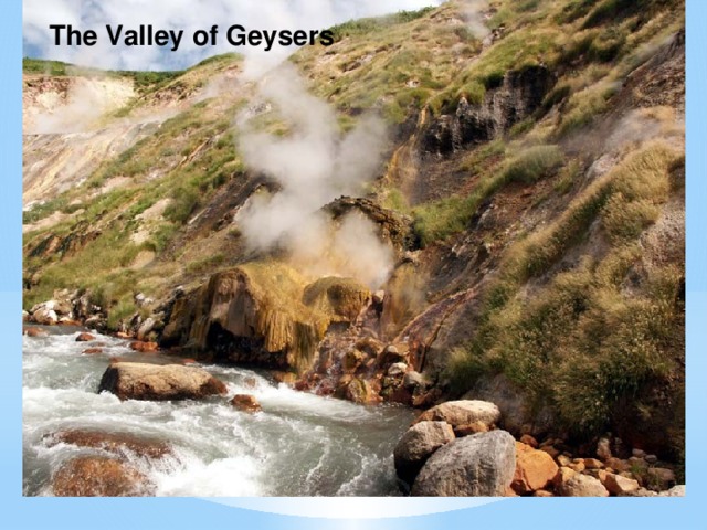
The Valley of Geysers
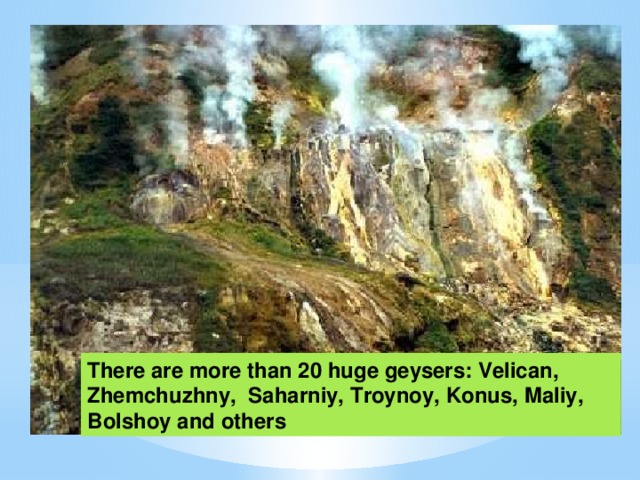
There are more than 20 huge geysers: Velican, Zhemchuzhny, Saharniy, Troynoy, Konus, Maliy, Bolshoy and others
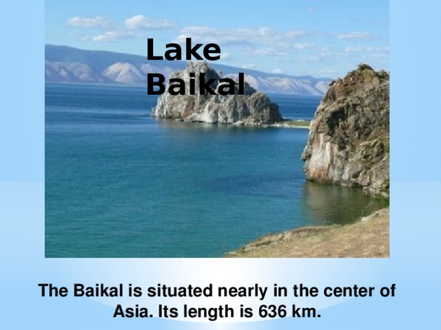
Lake Baikal
The Baikal is situated nearly in the center of Asia. Its length is 636 km.
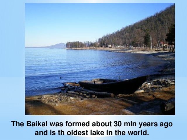
The Baikal was formed about 30 mln years ago and is th oldest lake in the world.
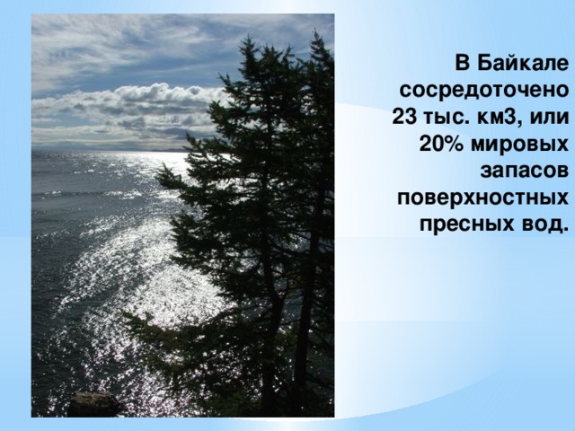
В Байкале сосредоточено 23 тыс. км3, или 20% мировых запасов поверхностных пресных вод.
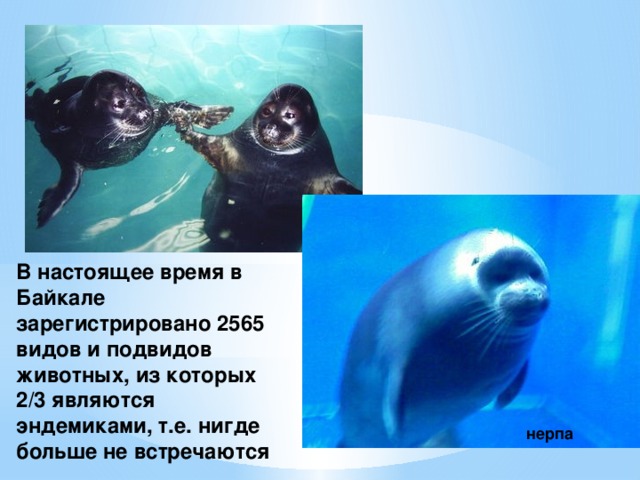
В настоящее время в Байкале зарегистрировано 2565 видов и подвидов животных, из которых 2/3 являются эндемиками, т.е. нигде больше не встречаются
нерпа
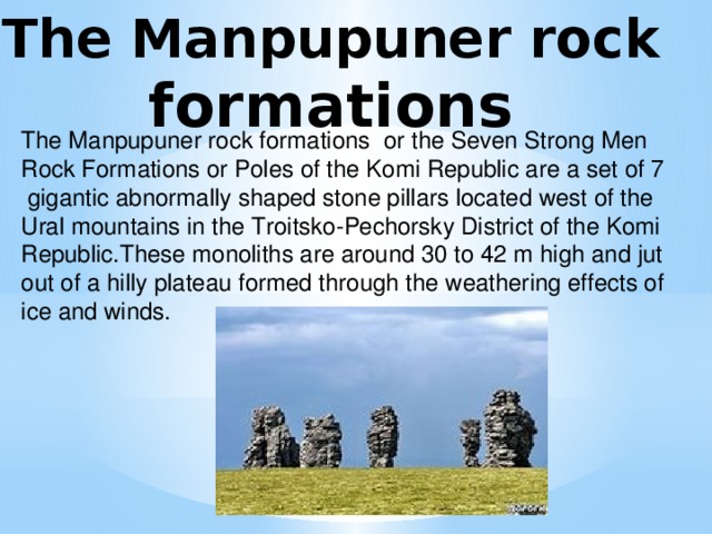
The Manpupuner rock
formations
The Manpupuner rock formations or the Seven Strong Men Rock Formations or Poles of the Komi Republic are a set of 7
gigantic abnormally shaped stone pillars located west of the Ural mountains in the Troitsko-Pechorsky District of the Komi Republic.These monoliths are around 30 to 42 m high and jut out of a hilly plateau formed through the weathering effects of ice and winds.
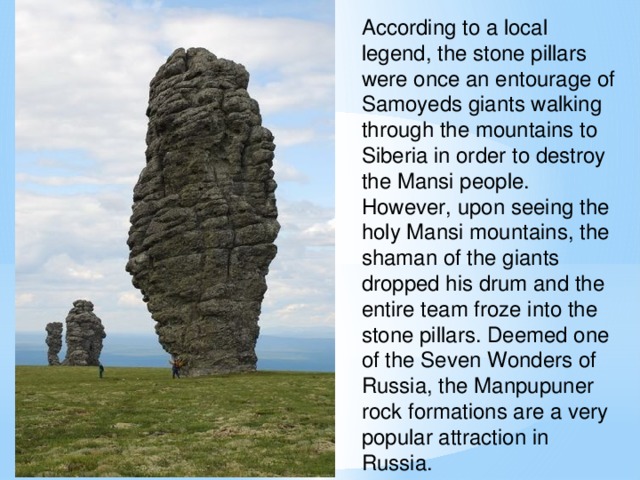
According to a local legend, the stone pillars were once an entourage of Samoyeds giants walking through the mountains to Siberia in order to destroy the Mansi people. However, upon seeing the holy Mansi mountains, the shaman of the giants dropped his drum and the entire team froze into the stone pillars. Deemed one of the Seven Wonders of Russia, the Manpupuner rock formations are a very popular attraction in Russia.
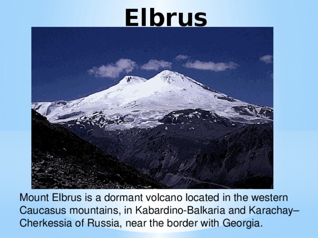
Elbrus
Mount Elbrus is a dormant volcano located in the western Caucasus mountains, in Kabardino-Balkaria and Karachay–Cherkessia of Russia, near the border with Georgia.
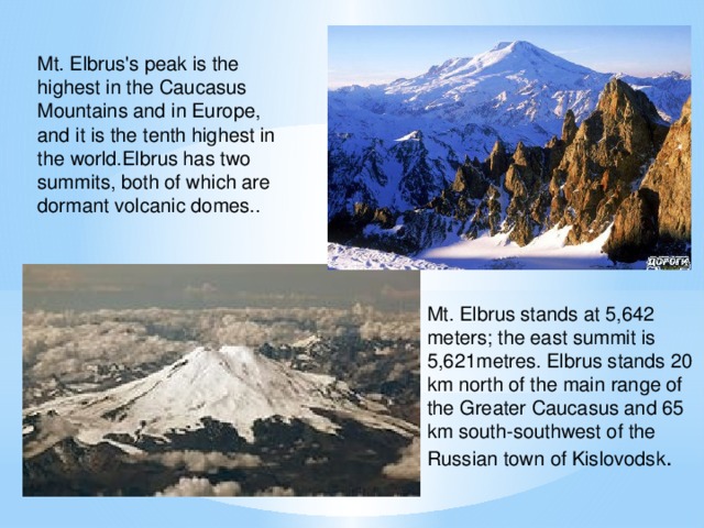
Mt. Elbrus's peak is the highest in the Caucasus
Mountains and in Europe,
and it is the tenth highest in the world.Elbrus has two summits, both of which are dormant volcanic domes..
Mt. Elbrus stands at 5,642 meters; the east summit is
5,621metres. Elbrus stands 20 km north of the main range of the Greater Caucasus and 65 km south-southwest of the Russian town of Kislovodsk .
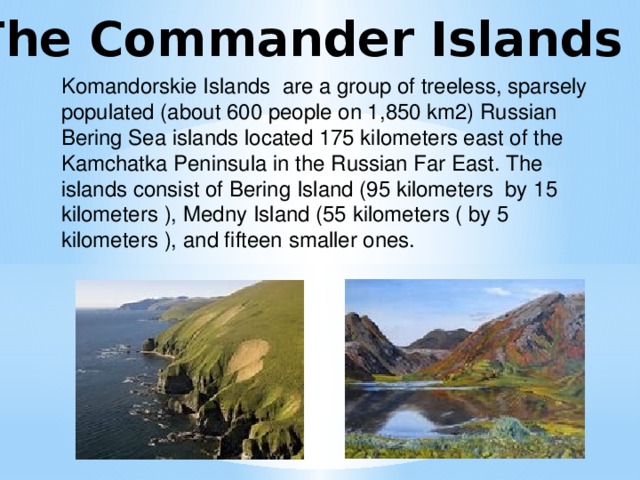
The Commander Islands
Komandorskie Islands are a group of treeless, sparsely populated (about 600 people on 1,850 km2) Russian Bering Sea islands located 175 kilometers east of the Kamchatka Peninsula in the Russian Far East. The islands consist of Bering Island (95 kilometers by 15 kilometers ), Medny Island (55 kilometers ( by 5 kilometers ), and fifteen smaller ones.
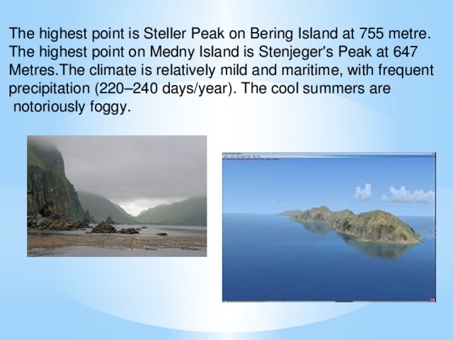
The highest point is Steller Peak on Bering Island at 755 metre.
The highest point on Medny Island is Stenjeger's Peak at 647
Metres.The climate is relatively mild and maritime, with frequent
precipitation (220–240 days/year). The cool summers are
notoriously foggy.
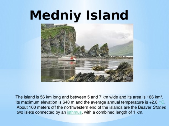
Medniy Island
The island is 56 km long and between 5 and 7 km wide and its area is 186 km².
Its maximum elevation is 640 m and the average annual temperature is +2.8 °C .
About 100 meters off the northwestern end of the islands are the Beaver Stones
two islets connected by an isthmus , with a combined length of 1 km.
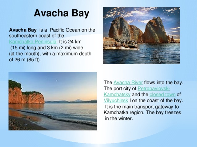
Avacha Bay
Avacha Bay is a Pacific Ocean on the southeastern coast of the
Kamchatka Peninsula . It is 24 km
(15 mi) long and 3 km (2 mi) wide
(at the mouth), with a maximum depth
of 26 m (85 ft).
The Avacha River flows into the bay.
The port city of Petropavlovsk-
Kamchatsky and the closed town of
Vilyuchinsk l on the coast of the bay.
It is the main transport gateway to
Kamchatka region. The bay freezes
in the winter.
![Kungur Ice Cave Kungur Ice Cave is a karst cave located in the Urals, near the town Kungur in Perm Krai, Russia,[1] on the right bank of the Sylva River. The cave is famous for its ice formations and is a popular tourist landmark. Kungur Ice Cave has been known since 1703 when Peter the Great issued the decree sending a well-known geographer S.U. Remezov from Tobolsk in Kungur. He worked out the Uyezd plan and made the first sketch of the cave.](https://fsd.kopilkaurokov.ru/uploads/user_file_569e74a6ad2fe/img_user_file_569e74a6ad2fe_16.jpg)
Kungur Ice Cave
Kungur Ice Cave is a karst cave located in the Urals, near the town Kungur in Perm Krai, Russia,[1] on the right bank of the Sylva River. The cave is famous for its ice formations and is a popular tourist landmark.
Kungur Ice Cave has been known since 1703 when Peter the Great issued the decree sending a well-known geographer S.U.
Remezov from Tobolsk in Kungur. He worked out the Uyezd plan and made the first sketch of the cave.
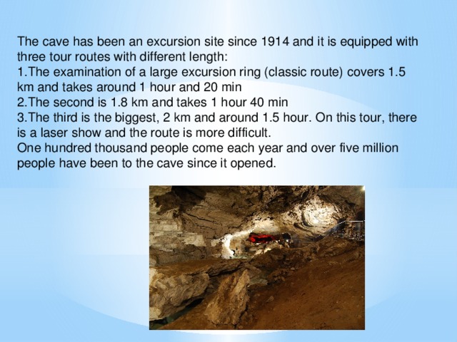
The cave has been an excursion site since 1914 and it is equipped with three tour routes with different length:
1.The examination of a large excursion ring (classic route) covers 1.5 km and takes around 1 hour and 20 min
2.The second is 1.8 km and takes 1 hour 40 min
3.The third is the biggest, 2 km and around 1.5 hour. On this tour, there is a laser show and the route is more difficult.
One hundred thousand people come each year and over five million people have been to the cave since it opened.
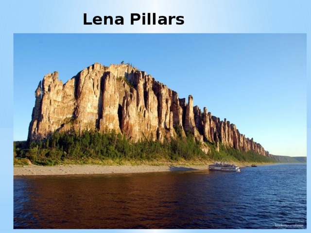
Lena Pillars
![Lena Pillars is the name given to a natural rock formation along the banks of the Lena River in far eastern Siberia. The pillars are 150–300 meters (490–980 ft) high, and were formed in some of the Cambrian period sea-basins. The Lena Pillars National Park was inscribed on the World Heritage List in 2012.[1] The site lies less than a day's boat ride upriver (south) from the city of Yakutsk, the capital of the autonomous Sakha Republic.[2]](https://fsd.kopilkaurokov.ru/uploads/user_file_569e74a6ad2fe/img_user_file_569e74a6ad2fe_19.jpg)
Lena Pillars is the name given to a natural rock formation along the banks of the Lena River in far eastern Siberia. The pillars are 150–300 meters (490–980 ft) high, and were formed in some of the Cambrian period sea-basins. The Lena Pillars National Park was inscribed on the World Heritage List in 2012.[1]
The site lies less than a day's boat ride upriver (south) from the city of Yakutsk, the capital of the autonomous Sakha Republic.[2]


Похожие файлы
Полезное для учителя


Распродажа видеоуроков!

1600 руб.
2660 руб.

1510 руб.
2510 руб.

1610 руб.
2690 руб.

1610 руб.
2690 руб.
ПОЛУЧИТЕ СВИДЕТЕЛЬСТВО МГНОВЕННО
* Свидетельство о публикации выдается БЕСПЛАТНО, СРАЗУ же после добавления Вами Вашей работы на сайт
Удобный поиск материалов для учителей
Проверка свидетельства