Theme: Countries.
Aims: 1. to develop skills of speaking and writing about countries and nationalities;
2. to teach children to use the new words in their speech;
3. to teach children to respect other countries and to love their motherland;
The visual aids: interactive board, map of the world, slides, charts.
Type of the lesson: new lesson.
Form of the lesson: lesson-trip
Plan of the lesson
- Organization moment.
2. Warm-up (Slides) Look at the map and try to guess which country is this.
Who has been aboard?
Have you been in China?
Have you ever been in Russia?
3. Phonetic drill:
Exercise 1Listen and repeat. Toss the ball
Country
Nationality
Capital
Kazakhstan
Kazakh
Astana
China
Chinese
Peking (Beijing)
Germany
German
Berlin
France
Frenchman
Paris
Egypt
Egyptian
Cairo
4. Match the Countries and languages (Slides)
Country Language
1. China Hindi, English
2. India Portuguese
3. Canada English
4. Brazil Chinese
5. Egypt English, French
6. Australia Arabic
5. Divide into three groups (you are given the text cutting into three parts you must find order of them)
a) Read the text.
Continents and Countries of the World
We know that the sun is the centre of solar system. There are seven planets in the solar system. The Earth is one of them. The Earth as other planets is round. If you look at the Earth from the space you will be able to see lands, seas, oceans, continents and different countries.
There are four oceans and six continents. The continents are Europe and Asia, Africa, America, Australia, Antarctic. America consists of North America and South America. The continents are very large. Oceans and seas wash them and separate them from each other.
If we look at the map of the world we shall see many countries and continents. There is only one country in Australia. It has got the same name as the continent. The largest country in the world is Russia and the smallest one is Vatican. Let us name some countries from each continent. Great Britain, Germany, France, Italy, Spain are in Europe. China, India, Pakistan and Kazakhstan are in Asia. Egypt and Tunis are in Africa. Russia is situated on the two continents: Europe and Asia.
The United States of America and Canada are in the North America. Brazil and Chile are in the South America.
People of different nationalities live in their countries. They speak different languages. Each country has its national flag, anthem and its own traditions and customs.
1) Name and show the continents on the map
2) Name the countries of Europe
3) Name the countries of Asia
b) True or false: - The sun is the center of Earth
- There are five oceans and seven continents
- Australia has got the same name as the continent
- The largest country in the world is China
- The smallest country is Vatican.
с) Fill in the gaps: (Slides)
- There are seven planets in______.
- America consists of ________.
- Oceans and seas______ them and ____ them from each other.
- There is only one_____ in Australia.
- ___of the world are different in their ___.
- Brazil and Chile are in the _____America.
- People of different____ live in their ____.
- Each country has its national____, _____ and its own ___and ____.
d) Give the definition of the word “Continent”
6. Map of the world (Slides)
Answer the questions:
- What will you be able to see from the space?
- How many oceans and continents are there on the earth?
- What are the names of the continents? Name all of them
- What can you say about the continent of America?
- What each country has?
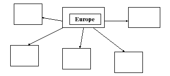
7. Relax. Fill in the diagram (map of the world)
8. Home task: Describe one of the country
9. Reflex ion: What did you learn today?
What was for the new?
Просмотр содержимого документа
«countries»
Lesson: English
Form: 6
Theme: Countries.
Aims: 1. to develop skills of speaking and writing about countries and nationalities;
2. to teach children to use the new words in their speech;
3. to teach children to respect other countries and to love their motherland;
The visual aids: interactive board, map of the world, slides, charts.
Type of the lesson: new lesson.
Form of the lesson: lesson-trip
Plan of the lesson
Organization moment.
2. Warm-up (Slides) Look at the map and try to guess which country is this.
Who has been aboard?
Have you been in China?
Have you ever been in Russia?
3. Phonetic drill:
Exercise 1Listen and repeat. Toss the ball
| Country | Nationality | Capital |
| Kazakhstan | Kazakh | Astana |
| China | Chinese | Peking (Beijing) |
| Germany | German | Berlin |
| France | Frenchman | Paris |
| Egypt | Egyptian | Cairo |
4. Match the Countries and languages (Slides)
Country Language
1. China Hindi, English
2. India Portuguese
3. Canada English
4. Brazil Chinese
5. Egypt English, French
6. Australia Arabic
5. Divide into three groups (you are given the text cutting into three parts you must find order of them)
a) Read the text.
Continents and Countries of the World
We know that the sun is the centre of solar system. There are seven planets in the solar system. The Earth is one of them. The Earth as other planets is round. If you look at the Earth from the space you will be able to see lands, seas, oceans, continents and different countries.
There are four oceans and six continents. The continents are Europe and Asia, Africa, America, Australia, Antarctic. America consists of North America and South America. The continents are very large. Oceans and seas wash them and separate them from each other.
If we look at the map of the world we shall see many countries and continents. There is only one country in Australia. It has got the same name as the continent. The largest country in the world is Russia and the smallest one is Vatican. Let us name some countries from each continent. Great Britain, Germany, France, Italy, Spain are in Europe. China, India, Pakistan and Kazakhstan are in Asia. Egypt and Tunis are in Africa. Russia is situated on the two continents: Europe and Asia.
The United States of America and Canada are in the North America. Brazil and Chile are in the South America.
People of different nationalities live in their countries. They speak different languages. Each country has its national flag, anthem and its own traditions and customs.
1) Name and show the continents on the map
2) Name the countries of Europe
3) Name the countries of Asia
b) True or false: - The sun is the center of Earth
- There are five oceans and seven continents
- Australia has got the same name as the continent
- The largest country in the world is China
- The smallest country is Vatican.
с) Fill in the gaps: (Slides)
There are seven planets in______.
America consists of ________.
Oceans and seas______ them and ____ them from each other.
There is only one_____ in Australia.
___of the world are different in their ___.
Brazil and Chile are in the _____America.
People of different____ live in their ____.
Each country has its national____, _____ and its own ___and ____.
d) Give the definition of the word “Continent”
6. Map of the world (Slides)
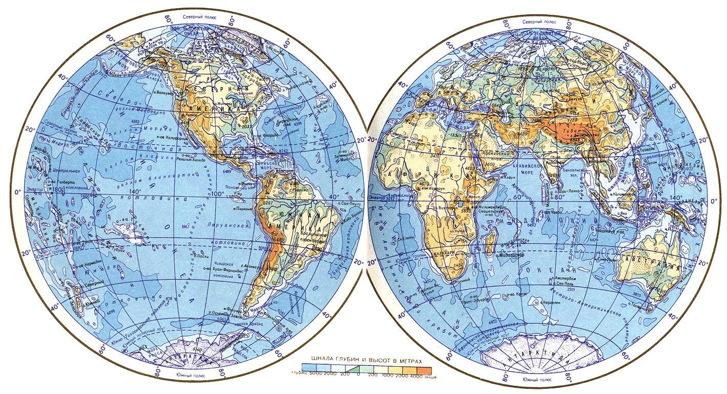
Answer the questions:
What will you be able to see from the space?
How many oceans and continents are there on the earth?
What are the names of the continents? Name all of them
What can you say about the continent of America?
What each country has?
7. Relax. Fill in the diagram (map of the world)
8. Home task: Describe one of the country
9. Reflex ion: What did you learn today?
What was for the new?


